
Hiking, Humphreys Peak, Arizona, USA
Humphreys Peak is the highest mountain in Arizona and resides in Coconino County, in the northern part of the state. It is the 26th most prominent mountain in the lower 48 states, rising over 6,000 feet. Humphreys Peak and the greater San Francisco Mountain is part of the Kachina Peaks Wilderness Area, which includes 18,960 acres.
Out of all the western states high points it is the easiest summit to hike. All the Guide books of hiking in Arizona will tell you that it is a strenuous hike, but compared to the rest of the western high points it’s easy to moderate. The top of the peak seams to be out of place in Arizona, almost giving you the feeling you’re not in Arizona anymore. It’s often referred to as “Arizona’s little Colorado.” Many people that don’t know anything about Arizona have no clue that there are 12,000-foot mountains in the state. The popular misconception is that Arizona is a flat desert with no trees or mountains and certainly not worth visiting.
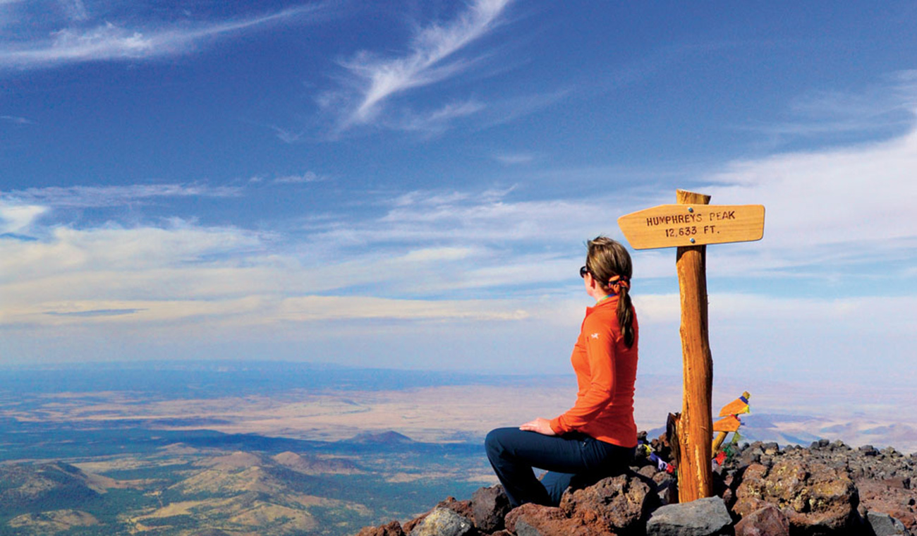
The views from the top are tremendous. To the north you can see the north rim the if Grand Canyon, to the east, the White Mountains and Holbrook, to the south, the desert Mountains near Phoenix are visible. Local legend has it that the name, “San Francisco Peaks” have been named that because one can see the city San Francisco, obviously not true.
Humphreys Peak was named after General A. A. Humphreys who was a US chief of Engineers.
There are 2 main routes that lead to the top, The Humphreys Peak trail (mentioned below) and the Weatherford Trail. The Weatherford trail was once a road that allowed Model T Fords to get up to 12,000 Feet. There is also the Inner Basin trail that connects to the Weatherford trail, which starts at Locket Meadow.
The Humphreys Trail starts at the Arizona Snow Bowl. This is the standard approach. The trail is very well marked until you reach the saddle. The first 3 miles the trail gradually climbs the mountain, then the last 1 3/4 miles it gets steeper and more difficult. After the saddle the trail can be hard to find at spots near the top. There are posts added on the last 3/4 of a mile to help mark the trail. If you loose the trail look for the posts. It is very rocky and loose above 12,000 feet. The trail ascends 3 false summits before reaching the true summit. The trail is moderate to difficult, but anybody in some sort of shape can make it if you don’t have any problems with elevation sickness. I’ve seen overweight people hike it to the top in horrible shape; it just took them all day. Total mileage is approximately 4 3/4 miles.
Visit USA. Epic USA Adventure Route © All Rights Reserved | Monika & Simon Newbound 2017


 Own or work here?